National Weather Service Training Center
on PMP and its application to the
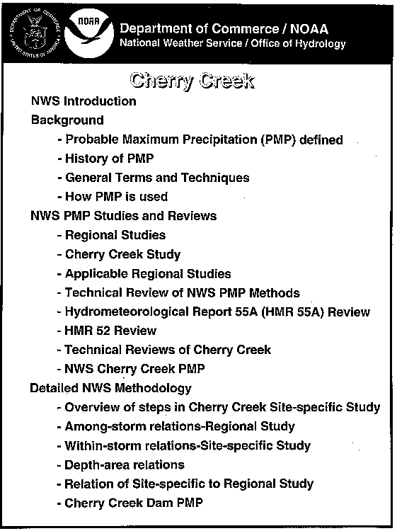
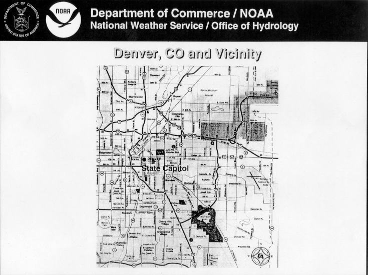
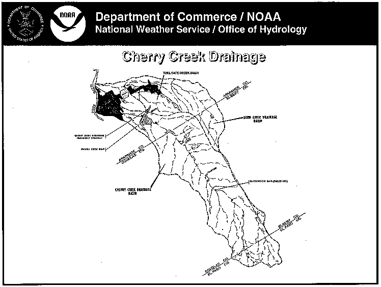
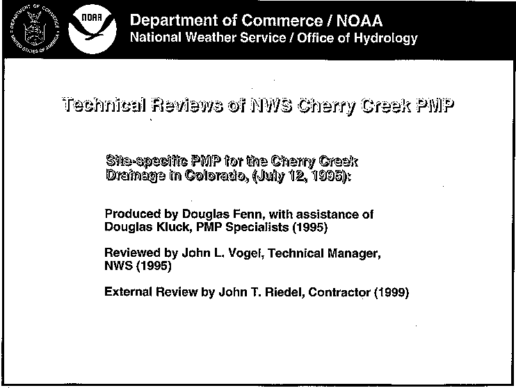
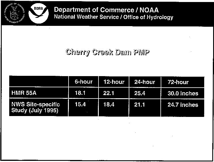
Cherry Creek, Colorado Site Specific Study


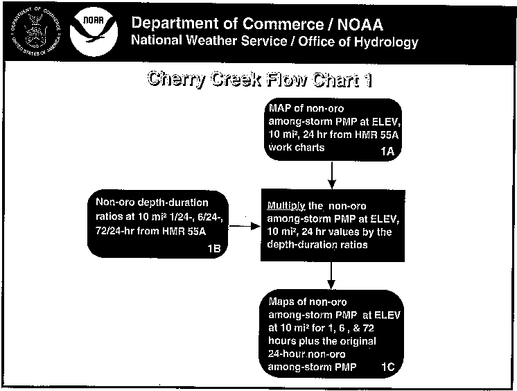
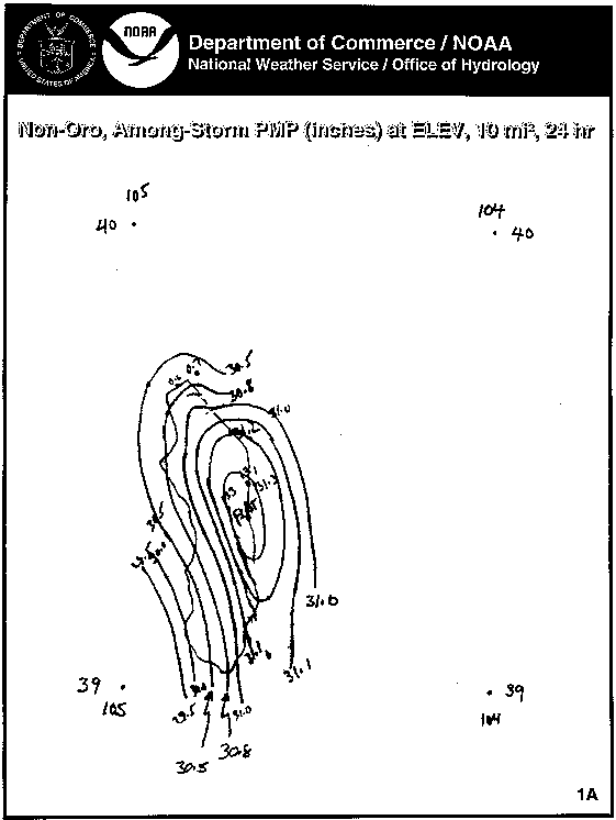
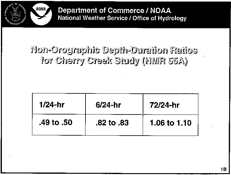
The following lecture notes were presented at the Technical Meeting with the National Weather Service about the Cherry Creek Site Specific Probable Maximum Precipitation Study on July 21, 1999. The meeting was organized by the U.S. Army Corp of Engineers. These notes are a nice overview of PMP methodologies.

Table of Contents:

** Cherry Creek **
  • Cherry Creek Outline

  • Denver, CO & Vicinity
  • Cherry Creek Drainage
  • Background Cover
  • Probable Max. Precipitation (PMP) Def.
  • History of PMP
  • Early Period
  • Regional Discharge Period
  • Discharge-probability Relation
  • Storm Transposition Period
  • Isohyetal Map
  • Plum Creek, CO
  • Probable Max. Precipitation Period
  • Gen. Terms & Techniques Cover
  • Principle Tools
  • Dew Point Temperature
  • Schematic: Comparative Diurnl Variation
  • Persisting Dew Points
  • Estimation of Probable Max. Precip.
  • Maximum Persisting 12-h 1000-hPa
  • Precipitable Water
  • Storm Maximization
  • Storm Transposition
  • Example of Storm Transposition
  • Steps in Transposition
  • Example of Transposition Limits
  • Trans. Limits of July Storm
  • Envelopment
  • Estimates for Mid- Latitude Non-Or. Reg.
  • Barrier
  • How is PMP used?
  • NWS PMP Studies and Reviews
  • How Does NWS Estimate PMP?
  • How Did NWS Estimate Cherry Creek?
  • Applicable Regional PMP Studies
  • Tech. Rev. of NWS PMP Methods
  • Hydrometeorological Report 55 A Rev.
  • HMR 52 Review
  • Tech. Rev. of NWS Cherry Creek
  • Cherry Creek Dam PMP
  • Detailed NWS Methodology
  • Among-storm Relations Study
  • Within-storm Relations Site Specific
  • Depth-Area Relationship
  • Relation of Site-Specific
  • Regional Limits for Terrain
  • Technique Limitations
  • Overview of Steps in C. Creek
  • Cherry Creek Dam PMP


  • ** Cherry Creek Site Specific Study **

  • C. Creek Site Specific Study Cover
  • Cherry Creek Flow Chart 1
  • Non-Oro, Among-storm PMP
  • Non-Oro Depth-Duration Ratios
  • Non-Oro, Among-storm PMP(2)
  • Cherry Creek Flow Chart 2
  • Total, Among-storm PMP
  • Orographic Influence Factors
  • Maximum Persisting Dew Pts.
  • Barrier/Smoothed Elev. Map
  • Vertical Adj. Chart (VAC)
  • Cherry Creek Flow Chart 3
  • C. Creek Drainage Avg. Depth
  • Avg. depth of Among-storm
  • Cherry Creek Flow Chart 4
  • DAD Relation, Min., Non-Oro
  • Basin Avg. Depths of Non-Oro
  • Avg. depth of Among-storm(2)
  • Cherry Creek Flow Chart 5
  • Vertical Adj. Chart (VAC)
  • Orographic Influence Factors
  • Cherry Creek Flow Chart 6
  • Isohyets of Most-Intense 6-hr Tot
  • C. Creek Drainage Avg. depth(2)
  • Cherry Creek Flow Chart 7
  • Basin Avg. Depths, Tot. Within-storm PMP
  • Avg. depth of within-storm PMP
  • A suggested chronology for the PMS


  • ** Antecedent Precipitation Study Approach **

  • Antecedent Precip. Cover
  • Area Where Precip. Sequences Were Selected
  • The Data
  • Data Summations
  • Ex.: The seq. of July 3, 1981
  • Finding from Station Data
  • Mean & Median Antecendent Precip.
  • Avg. Antecedent Precip. Ratio
  • Monthly Variation of APR
  • 2 Month, Running Avg.
  • NWS Recommendations for C. Creek


  • Questions or Comments About This Page? E.Mail the Webmaster.